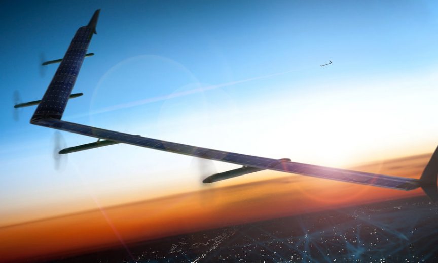
Drones are on the rise. In fact, use of drones is only limited by our imagination – from merely recreational (think “drone races”) to delivering packages (as promised by Amazon) to a range of life-saving military uses (such as real-time battlefield imaging). Emerging high speed, small size, and highly efficient gallium nitride power semiconductors are key contributors to the expansion of drone applications, including onboard equipment such as LiDAR imaging and navigation systems and 4G/5G communication transmitters. Let’s take a look at how GaN technology and the expansion of drone applications intersect.

A drone, or more technically, an unmanned aerial vehicle (UAV) is an aircraft without a pilot on board. Control of the drone is accomplished either under remote control from the ground or under control of an onboard computer.
Although drones originated mostly in military applications, civilian drones now vastly outnumber military drones, with estimates of over 9 million consumer drones to be sold in 2016 world wide for a total market value of near $3 billion.
And, the uses of drones are rapidly expanding to a wide range, and previously unthought-of applications – commercial, scientific, industrial, surveillance, agricultural, medical support, and, of course, recreational. In fact, the uses for drones are limited only by our imagination.
Providing Power to Onboard Drone Electronics
As unmanned battery-powered aircraft, drones, have a lot of electronic componentsrequiring various levels of electrical power onboard and GaN FETs and ICs can deliver the power needed efficiently to the point where power is needed – for example, to the battery control system, the sensors for gathering performance information, the GPS navigation system, the all-important micropressor, and the motor drives that actuate the propellers and other flying surfaces. Each of these critical components requires different levels of power at different time intervals. In these applications, the higher efficiency, smaller size, lower weight, and lower cost of eGaN FETs and ICs, such as those offered by Efficient Power Conversion (EPC), are superior to traditional silicon-based MOSFETS.

Mid-air Recharging
As the distances drones have to fly increase for applications such as package delivery, medical supplies delivery to remote area and in support of military operations, the need to recharge the onboard batteries of the drone while in route becomes necessary. Typically, high-end (quadcopter) drones can only fly for about 25 minutes.
An innovative way of recharging the batteries is to place “mid-air recharging stations” along the route of the drone.
Strategically located on communication towers, atop streetlights, and building rooftops, these refueling (or recharging) stations provide wireless charging antennae from which drones can have their batteries recharged wirelessly without having to land. Just think, those planning the use of drones for long-distance assignments could create a solar powered “recharging flight path” to remote parts of the world in order to deliver life-saving medicines – for example, through a jungle to isolated villages or to ice-bound sections of Alaska or northern Canada during the winter season.
Wireless charging is a signature application for GaN technology. Its high switching capability means that, along with GaN’s small size, smaller complementary circuit components can be used to create a compact wireless power transmit board for the charging system.
Powering the Drone’s Motors
Typically there are four to eight motors used to drive the rotor blades for lift and propulsion of a helicopter-type drone. GaN FETs and ICs are an excellent choice due to their small size and high switching speed. With the GaN transistor switching faster than the traditional MOSFET, the speed of the motors can be controlled more precisely.
In addition to having a vital role for the onboard electronic of the drone, GaN FETs and ICs have many opportunities for being used in a wide range of “payload systems” being carried aloft by the drone. Let’s look at a few.
Enabling Drones to be Micro Base Stations for Communications
With the ever-increasing rise in data and voice communications, companies like Google and AT&T are looking to use drones as mobile 4G, and eventually 5G, mobile communication cell phone base stations. For example, AT&T is proposing to use COWs (Cells on Wings) drones as mobile base stations to beef up cell phone signals during heavily attended sporting events and concerts. These flying base stations will be used to supplement local land-based stations when they are taxed with the excessive communications traffic of those attending the events.

Uniquely suited for contributing to the implementation of the energy, size, and weight-saving transmission enabled by envelope tracking, GaN is the only transistor technology that can switch at the extremely high rates of speed needed to track the signal being transmitted. Envelope tracking, although a well-known technology, is enabled by the fast switching speed of GaN FETs and ICs and is emerging with 4G and will be essential for the implementation of 5G LTE.

Airborne LiDAR systems are widely used for three-dimensional mapping and more recently considered as a technology to become the “eyes” for autonomous drones. Using LiDAR for vehicular navigation is not just limited to ground use; as a matter of fact, when coupled with GPS and the inertial information (pitch, yaw, roll) of the drone, a LiDAR system can accurately provide a three-dimensional map of the surroundings giving the drone an onboard, real-time, fully autonomous guidance system. As a payload onboard a drone, a LiDAR system is the foundation for many 3D mapping and surveillance applications. Let’s look at a few emerging uses for LiDAR, but first let’s discuss the contribution GaN technology makes to the performance of the LiDAR system and the accuracy of the images it produces.
GaN’s Contribution to LiDAR
Using the speed of light as a reference, LIDAR is an active method for remotely sensing objects. Simply put, it records the time it takes for a laser pulse to be sent and received after striking a distant object. The distance and image of the object is calculated from this information. By directing the laser around 360 degrees allows system to identify objects in the entire 3-D environment surrounding the LiDAR unit.
Knowing the precise time when the light pulses are triggered, and when they return to the sensor, contributes significantly to the accuracy of the image the LiDAR system creates. GaN FETs’ and ICs’ fast switching capability enables more accurate determination of the distance measurements between the time the light pulses are fired and the time they are received.

Also, since only a small amount of the light will be reflected back to the sensors, the ability of GaN components to deliver more power to the laser results in a more intense laser beam output, enabling the LiDAR system to “see” at a greater distance, or in less than perfect atmospheric conditions.
Generating a series of laser pulses that take snapshots of the entire surroundings, one pulse at a time, creates the full three-dimensional LiDAR image. The speed of GaN allows for much shorter pulses of light that consumes less power and creates a full 3-D image much faster and with higher resolution than with slower, silicon-based electronics.

Military Applications
Several military applications are known to be available, such as reconnaissance flights, to provide real time, extremely accurate landscapes. In addition to the gathering of general three-dimensional topographical mapping, a LiDAR equipped drone can provide information about building and enemy locations, as well as troop movements ahead in the surrounding area. With LiDAR-equipped drones flying ahead of troops, the mapping information “seen” by the drone is transmitted to the troops in real time. The information is presented to the troops using augmented reality headsets, thus providing the troop with vital, life-saving “soldier point of view” rapidly generated from the drone’s “God’s eye view” of the battlefield.

Interestingly, the drone carrying the LiDAR reconnaissance equipment may itself have a LiDAR navigation system. With LiDAR, the drone can fly safely at high rates of speed and low to the ground anticipating obstacles and setting the best flight path to spotlight enemy terrain and movements.
Topographical Mapping
Similar to the military use, perhaps the most widespread commercial use of airborne LiDAR systems today is for three-dimensional mapping. This form of mapping provides important information for many operations such as mining, forestry maturation, soil erosion, and agriculture.

In agricultural applications, drone mounted LiDAR can be used to help farmers determine which areas of their fields to apply costly fertilizer to determine crop yields from various portions of the farm. These results will indicate the best locations to apply fertilizer. Crop mapping in orchards and vineyards are other agricultural applications. Drones equipped with LiDAR can monitor plant growth to determine if pruning is needed and to detect variations in fruit production.
In forestry, LiDAR mounted drones are used to scan forests not only to count trees but also to determine the growth and health of the forest. In a similar fashion, geologists and mining experts uses LiDAR mapping information to locate land deformities, slope erosion and possible mineral deposits.
And, LiDAR systems are not just for land use. Systems using “green light” are capable of penetrating water and mapping objects and the terrain below the surface. This water penetrating form of LiDAR is used to study underwater topography. Bathymetric use of drones are being used for aerial 3-D mapping of the coastal line, as well as for mapping ocean, river and lake floors, and explorations for underwater wreckage.

The drones are coming…
There is no doubt, drones are on the move; flying high and gaining momentum with the expansion of their practical use – recreational, delivering medicine, assisting soldiers in combat, and mapping terrain and ocean floors, just to name a few. Gallium nitride power semiconductors, with their high switching speed, small size, and highly efficiency are key contributors to this expansion of applications for drones and their onboard equipment.
The uses for drones are only limited by our imagination – certainly beyond the 192 future uses identified by futurist Thomas Frey. The growth of GaN technology and its use to support advances in the performance of drones and onboard equipment, will significantly contribute to the expansion of the use of drones! So, it is up, up and away for these technologies!
Last modified: September 22, 2016


